» książki » Reference - Atlases, Gazetteers & Maps (see also Travel - Maps & Road Atlases)
Kategoria BISAC: Reference >> Atlases, Gazetteers & Maps (see also Travel - Maps & Road Atlases)
ilość książek w kategorii: 1748
 |
Sri Lanka Travel Map Third Edition
ISBN: 9780794606039 / Angielski / Mapa, składana / 1 str. Termin realizacji zamówienia: ok. 5-8 dni roboczych. The Sri Lanka Travel Map from Periplus is designed as a convenient, easy-to-use tool for travelers. Created using durable coated paper, this map is made to open and fold multiple times, whether it's the entire map that you want to view or one panel at a time. Following highways and byways, this map will show you how to maneuver your way to banks, gardens, hotels, golf courses, museums, monuments, restaurants, churches and temples, movie theaters, shopping centers and more This 3rd edition includes maps and plans that are scaled to: Area Map:
The Sri Lanka Travel Map from Periplus is designed as a convenient, easy-to-use tool for travelers. Created using durable coated paper, this ma...
|
cena:
40,31 |
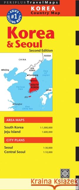 |
Periplus: Korea & Seoul Country Map
ISBN: 9780794606206 / Angielski / Folded Termin realizacji zamówienia: ok. 5-8 dni roboczych. The Korea & Seoul Travel Map from Periplus is designed as a convenient, easy-to-use tool for travelers. Created using durable coated paper, this map is made to open and fold multiple times, whether it's the entire map that you want to view or one panel at a time. Following highways and byways, this map will show you how to maneuver your way to banks, gardens, hotels, golf courses, museums, monuments, restaurants, churches and temples, movie theaters, shopping centers and more This 2nd edition includes maps and plans that are scaled to: Area Maps:
The Korea & Seoul Travel Map from Periplus is designed as a convenient, easy-to-use tool for travelers. Created using durable coated paper, th...
|
cena:
34,21 |
 |
The Routledge Atlas of American History
ISBN: 9780415488396 / Angielski / Miękka / 182 str. Termin realizacji zamówienia: ok. 5-8 dni roboczych. This edition charts the complete history of America, from early settlement to the present day using 157 clear and detailed maps. It includes the 2004 presidential election and the 'War on Terror'.
This edition charts the complete history of America, from early settlement to the present day using 157 clear and detailed maps. It includes the 2004 ...
|
cena:
121,64 |
 |
Atlas of Global Development : A Visual Guide to the World's Greatest Challenges
ISBN: 9780821385838 / Angielski / Miękka / 250 str. Termin realizacji zamówienia: ok. 5-8 dni roboczych. The Atlas of Global Development -- a comprehensive guide to the most critical issues facing our changing world Co-published with HarperCollins, the new edition has been completely revised and updated, presenting a comprehensive overview of the world and its people at the start of the 21st century. Every topic is presented through easy-to-read graphical presentations including colourful world maps, charts, tables, graphs, photographs and web addresses of additional data sources. * A visual guide to global issues - easy-to-read graphical presentation with every topic...The Atlas of Global Development -- a comprehensive guide to the most critical issues facing our changing world Co-published wi... |
cena:
121,64 |
 |
Wildfire Through Staffordshire
ISBN: 9781844917976 / Angielski / Twarda Termin realizacji zamówienia: ok. 5-8 dni roboczych. The first of two volumes, Wildfire through Staffordshire presents the very best from Osborne, Wild and Roscoe, who each published their own early Railway Traveller's Guides shortly after the opening of the country's first ground-breaking trunk line, the Grand Junction railway, on the 4th of July 1837. This publication is lavishly and uniquely supplemented with commissioned poems by Ian Henery as well as many antique views, vistas and rare maps from the period, and covers the first half of the journey from Birmingham to Liverpool or Manchester. The second volume continues as the Wildfire...
The first of two volumes, Wildfire through Staffordshire presents the very best from Osborne, Wild and Roscoe, who each published their own early Rail...
|
cena:
100,84 |
 |
Tokyo Travel Map Fourth Edition
ISBN: 9784805311844 / Angielski / Folded / 1 str. Termin realizacji zamówienia: ok. 5-8 dni roboczych. The Tokyo Travel Map from Periplus is designed as a convenient, easy-to-use tool for travelers. Created using durable coated paper, this map is made to open and fold multiple times, whether it's the entire map that you want to view or one panel at a time. Following highways and byways, this map will show you how to maneuver your way to banks, gardens, hotels, golf courses, museums, monuments, restaurants, churches and temples, movie theaters, shopping centers and more This 4th edition includes maps and plans that are scaled to: City Plans:
The Tokyo Travel Map from Periplus is designed as a convenient, easy-to-use tool for travelers. Created using durable coated paper, this map ...
|
cena:
34,21 |
 |
Historical Atlas of Northeast Asia, 1590-2010: Korea, Manchuria, Mongolia, Eastern Siberia
ISBN: 9780231160704 / Angielski / Twarda / 352 str. Termin realizacji zamówienia: ok. 5-8 dni roboczych. Four hundred years ago, indigenous peoples occupied the vast region that today encompasses Korea, Manchuria, the Mongolian Plateau, and Eastern Siberia. Over time, these populations struggled to maintain autonomy as Russia, China, and Japan sought hegemony over the region. Especially from the turn of the twentieth century onward, indigenous peoples pursued self-determination in a number of ways, and new states, many of them now largely forgotten, rose and fell as great power imperialism, indigenous nationalism, and modern ideologies competed for dominance. This atlas tracks the political...
Four hundred years ago, indigenous peoples occupied the vast region that today encompasses Korea, Manchuria, the Mongolian Plateau, and Eastern Siberi...
|
cena:
748,10 |
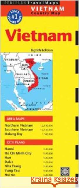 |
Vietnam Travel Map Eighth Edition
ISBN: 9780794607494 / Angielski / Mapa / 1 str. Termin realizacji zamówienia: ok. 5-8 dni roboczych. The Vietnam Travel Map from Periplus is designed as a convenient, easy-to-use tool for travelers. Designed to fit easily into a purse or pocket and created using durable coated paper, this map is made to open and fold multiple times, whether it's the entire map that you want to view or one panel at a time. Following highways and byways, this map will show you how to maneuver your way to banks, gardens, hotels, golf courses, museums, monuments, restaurants, churches and temples, movie theaters, shopping centers and more, including ALL the places you'll want to visit on your trip ...
The Vietnam Travel Map from Periplus is designed as a convenient, easy-to-use tool for travelers. Designed to fit easily into a purse or pocket...
|
cena:
34,21 |
 |
Ilustrowana Encyklopedia. Atlas świata
ISBN: 9788377405987 / Polski / Twarda / 32 str. Termin realizacji zamówienia: ok. 5-8 dni roboczych. ILUSTROWANA ENCYKLOPEDIA to seria ciekawych i pouczających książek z różnych dziedzin, które stanowią cenną pomoc w poznawaniu świata. Młody czytelnik znajdzie tu wiele interesujących i zdumiewających informacji. Zapraszamy do lektury!
ILUSTROWANA ENCYKLOPEDIA to seria ciekawych i pouczających książek z różnych dziedzin, które stanowią cenną pomoc w poznawaniu świata. Młody...
|
cena:
19,90 |
 |
Myanmar Travel Map Fourth Edition: (Burma Travel Map)
ISBN: 9780794607623 / Angielski / Folded Termin realizacji zamówienia: ok. 5-8 dni roboczych. The Myanmar Travel Map from Periplus is designed as a convenient, easy-to-use tool for travelers. Created using durable coated paper, this map is made to open and fold multiple times, whether it's the entire map that you want to view or one panel at a time. Following highways and byways, this map will show you how to maneuver your way to banks, gardens, hotels, golf courses, museums, monuments, restaurants, churches and temples, movie theaters, shopping centers and more This 4th edition includes maps and plans that are scaled to: Area Map:
The Myanmar Travel Map from Periplus is designed as a convenient, easy-to-use tool for travelers. Created using durable coated paper, this ma...
|
cena:
34,21 |
 |
National Geographic Colorado Wall Map - Laminated (40.5 X 30.25 In)
ISBN: 9781597752350 / Angielski / Not Folded / 1 str. Termin realizacji zamówienia: ok. 5-8 dni roboczych. The spectacular topography of the Centennial State is expertly rendered on National Geographic's wall map of Colorado. Part of the growing series of State Wall Maps, this map depicts Colorado's diverse terrain and vegetation in remarkable detail. Mountain ranges, prominent peaks, major lakes, rivers, and reservoirs, and other geographic features are highlighted. In addition to hundreds of place names, this map includes the precise locations of cities, major roadways and railways, airports, military installations, federal and state parks, and protected areas. Prominent recreation features... The spectacular topography of the Centennial State is expertly rendered on National Geographic's wall map of Colorado. Part of the growing series o... |
cena:
133,58 |
 |
Physical and Information Models in Geography (Routledge Revivals)
ISBN: 9780415658867 / Angielski / Miękka / 298 str. Termin realizacji zamówienia: ok. 5-8 dni roboczych. First published in 1967, this book explores the theme of geographical generalization, or model building. It is composed of eight of the chapters from the original Models in Geography, published in 1967. The first chapter broadly outlines geographical generalization and examines the nature and function of generalized statements, ranging from conceptual models to scale models, in a geographical context. The following chapter deals with model theory in a wider scientific framework and the rest of the book discusses models of physical systems and information models. The book considers model-type...
First published in 1967, this book explores the theme of geographical generalization, or model building. It is composed of eight of the chapters from ...
|
cena:
189,80 |
 |
Wuppertal (Elberfeld) 1945: Wuppertal Sheet 1
ISBN: 9781847847737 / Angielski / Mapa, składana Termin realizacji zamówienia: ok. 5-8 dni roboczych. |
cena:
42,14 |
 |
Geographic Dictionary of Connecticut and Rhode Island. Two Volumes in One
ISBN: 9780806308203 / Angielski / Miękka / 94 str. Termin realizacji zamówienia: ok. 5-8 dni roboczych. |
cena:
82,40 |
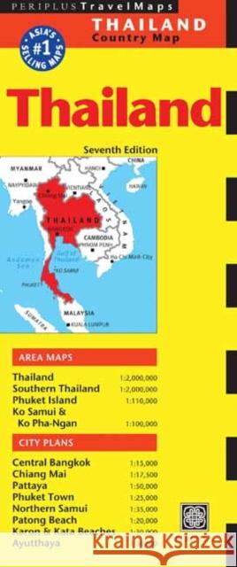 |
Thailand Travel Map Seventh Edition
ISBN: 9780794607081 / Angielski / Folded Termin realizacji zamówienia: ok. 5-8 dni roboczych. The Thailand Travel Map from Periplus is designed as a convenient, easy-to-use tool for travelers. Created using durable coated paper, this map of Thailand is made to open and fold multiple times, whether it's the entire map that you want to view or one panel at a time. Following highways and byways, this Thailand map will show you how to maneuver your way to banks, gardens, hotels, golf courses, museums, monuments, restaurants, churches and temples, movie theaters, shopping centers and more This 7th edition includes maps and plans that are scaled to: Area Maps:...
The Thailand Travel Map from Periplus is designed as a convenient, easy-to-use tool for travelers. Created using durable coated paper, this m...
|
cena:
34,21 |
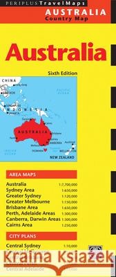 |
Australia Travel Map Sixth Edition
ISBN: 9780794607685 / Angielski / Mapa, składana Termin realizacji zamówienia: ok. 5-8 dni roboczych. The Australia Travel Map from Periplus is designed as a convenient, easy-to-use tool for travelers. Created using durable coated paper, this map of Australia is made to open and fold multiple times, whether it's the entire map that you want to view or one panel at a time. Following highways and byways, this Australia map will show you how to maneuver your way to banks, gardens, hotels, golf courses, museums, monuments, restaurants, churches and temples, movie theaters, shopping centers and more This 6th edition includes area maps and city plans that are scaled to:
The Australia Travel Map from Periplus is designed as a convenient, easy-to-use tool for travelers. Created using durable coated paper, this ...
|
cena:
34,21 |
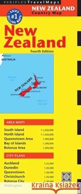 |
New Zealand Travel Map Fourth Edition
ISBN: 9780794607708 / Angielski / Mapa Termin realizacji zamówienia: ok. 5-8 dni roboczych. The New Zealand Travel Map from Periplus is designed as a convenient, easy-to-use tool for travelers. Created using durable coated paper, this map of New Zealand is made to open and fold multiple times, whether it's the entire map that you want to view or one panel at a time. Following highways and byways, this New Zealand map will show you how to maneuver your way to banks, gardens, hotels, golf courses, museums, monuments, restaurants, churches and temples, movie theaters, shopping centers and more This 4th edition includes maps and plans that are scaled to: Area...
The New Zealand Travel Map from Periplus is designed as a convenient, easy-to-use tool for travelers. Created using durable coated paper, thi...
|
cena:
34,21 |
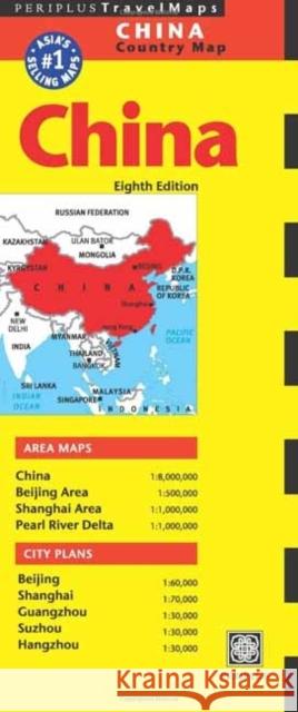 |
China Travel Map Eighth Edition
ISBN: 9780794607715 / Angielski / Other Termin realizacji zamówienia: ok. 5-8 dni roboczych. The China Travel Map from Periplus is designed as a convenient, easy-to-use tool for travelers. Created using durable coated paper, this map of China is made to open and fold multiple times, whether it's the entire map that you want to view or one panel at a time. Following highways and byways, this China map will show you how to maneuver your way to banks, gardens, hotels, golf courses, museums, monuments, restaurants, churches and temples, movie theaters, shopping centers and more This 8th edition includes area maps and city plans that are scaled to:
The China Travel Map from Periplus is designed as a convenient, easy-to-use tool for travelers. Created using durable coated paper, this map ...
|
cena:
34,21 |
 |
A Gazetteer of Indian Territory
ISBN: 9781596410138 / Angielski / Miękka / 78 str. Termin realizacji zamówienia: ok. 5-8 dni roboczych. United States Geological Survey 248, Series F, Geography 44. A gazetteer is a geographical dictionary or directory used in conjunction with a map or atlas that can provide detailed information about dates, locations, settlements, county boundaries, population, and more. For the historical or genealogical researcher, they are especially useful when attempting to locate an ancestor or an event in a given location years prior, but that named location is no longer shown on maps or in recent literature. This work contains an extensive list, arranged alphabetically, of Indian Territory place names...
United States Geological Survey 248, Series F, Geography 44. A gazetteer is a geographical dictionary or directory used in conjunction with a map or a...
|
cena:
72,78 |
 |
Dublin 1847: city of the Ordnance Survey
ISBN: 9781908996350 / Angielski / Miękka / 108 str. Termin realizacji zamówienia: ok. 5-8 dni roboczych. The Ordnance Survey's large-scale town plans for Dublin (1847) are the focus of this book. Forty-five extracts from these richly detailed maps depict the streets, lanes, buildings, gardens, yards and parks of the city with precision, to the extent that individual houses (with numbers), pumps, lamp posts and trees are shown. Author Frank Cullen considers selected features and areas of the mid-nineteenth-century city through the map extracts, using other sources to discuss the elements of urban life that lie behind maps. For example, the formal layout of Merrion Square with its fine buildings...
The Ordnance Survey's large-scale town plans for Dublin (1847) are the focus of this book. Forty-five extracts from these richly detailed maps depict ...
|
cena:
76,86 |


