Wyniki wyszukiwania:
wyszukanych pozycji: 25
 |
RELIEFS CÔTIERS ET CHANGEMENTS DU LITTORAL SUR LA CÔTE DE POINT CALIMERE, INDE
ISBN: 9786205566473 / Francuski / Miękka / 96 str. Termin realizacji zamówienia: ok. 10-14 dni roboczych. L'objectif de cette recherche était d'évaluer les changements du littoral en comparant les données satellitaires de 1980 à 2020. La zone d'étude se situe dans la région entre Kodiakarai et Nagapattinam sur la côte est de l'Inde, qui a souvent été perturbée par des ondes de tempête et des cyclones dans la baie du Bengale. Le DSAS détecte et mesure les positions du littoral d'érosion et d'accrétion grâce aux statistiques du SCE, NSM, EPR, LRR, et WLR. Les résultats montrent que le littoral de Kodiakkarai à Nagapattinam a subi une érosion sévère de 17,7% au total avec un taux...
L'objectif de cette recherche était d'évaluer les changements du littoral en comparant les données satellitaires de 1980 à 2020. La zone d'étude ...
|
cena:
227,67 |
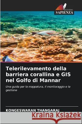 |
Telerilevamento della barriera corallina e GIS nel Golfo di Mannar
ISBN: 9786205169360 / Włoski Termin realizacji zamówienia: ok. 10-14 dni roboczych. |
cena:
227,67 |
 |
Impatto Dello Tsunami Sulle Forme Costiere Della Costa Di Nagapattinam, in India
ISBN: 9786205622438 / Włoski Termin realizacji zamówienia: ok. 10-14 dni roboczych. |
cena:
196,36 |
 |
FORME COSTIERE E CAMBIAMENTI DELLA LINEA DI RIVA NELLA COSTA DI POINT CALIMERE, IN INDIA
ISBN: 9786205566480 / Włoski / Miękka / 96 str. Termin realizacji zamówienia: ok. 10-14 dni roboczych. |
cena:
227,67 |
 |
La géomatique dans la collecte et la gestion des inondations dans la région de Tiruchirappalli
ISBN: 9786205254561 / Francuski / Miękka / 60 str. Termin realizacji zamówienia: ok. 10-14 dni roboczych. La pénurie d'eau a souvent un impact sur les personnes qui vivent dans des régions semi-arides où les précipitations sont insuffisantes. Afin de trouver des emplacements appropriés pour la collecte des eaux de crue afin de provoquer une recharge artificielle qui augmente le niveau des eaux souterraines, la région du delta supérieur du bassin de la rivière Cauvery dans le sud de l'Inde a été choisie. L'objectif de cette étude est la récolte des eaux de crue en utilisant la conception technique et la sélection des emplacements pour les structures de recharge artificielle. Les SIG...
La pénurie d'eau a souvent un impact sur les personnes qui vivent dans des régions semi-arides où les précipitations sont insuffisantes. Afin de t...
|
cena:
196,36 |
 |
Geomatik in der Hochwassernutzung und -verwaltung in einem Teil von Tiruchirappalli
ISBN: 9786205254592 / Miękka / 60 str. Termin realizacji zamówienia: ok. 10-14 dni roboczych. Wasserknappheit hat häufig Auswirkungen auf diejenigen, die in semiariden Regionen mit unzureichenden Niederschlägen leben. Um geeignete Standorte für die Hochwasserentnahme zur künstlichen Anreicherung zu finden, die den Grundwasserspiegel anhebt, wurde die obere Deltaregion des Cauvery-Flussbeckens in Südindien ausgewählt. Das Ziel dieser Studie ist die Hochwasserentnahme durch technische Planung und Standortwahl für künstliche Anreicherungsstrukturen. Mit Hilfe von GIS wurde die Hochwassergefahrenkarte erstellt und geeignete Gebiete für die Hochwasserentnahme empfohlen. Auf der...
Wasserknappheit hat häufig Auswirkungen auf diejenigen, die in semiariden Regionen mit unzureichenden Niederschlägen leben. Um geeignete Standorte f...
|
cena:
196,36 |
 |
COASTAL LANDFORMS & SHORELINE CHANGES IN POINT CALIMERE COAST, INDIA
ISBN: 9786205520468 / Angielski / Miękka / 88 str. Termin realizacji zamówienia: ok. 10-14 dni roboczych. The focus of this research was to assess the shoreline changes by comparing the satellite data from 1980 to 2020. The study area falls in the region between Kodiakarai and Nagapattinam of the east coast of India, which has frequently been distressed by storm surges and cyclones in the Bay of Bengal. The DSAS detects and measures the erosional and accretional shoreline positions through the statistics of the SCE, NSM, EPR, LRR, & WLR. The results show that the shoreline from Kodiakkarai to Nagapattinam suffered severe erosion of 17.7% in total with an average annual erosion rate of 3.4 m/year...
The focus of this research was to assess the shoreline changes by comparing the satellite data from 1980 to 2020. The study area falls in the region b...
|
cena:
227,67 |
 |
Detecção remota e SIG de recife de coral no Golfo de Mannar
ISBN: 9786205169346 / Portugalski / Miękka / 2022 / 80 str. Termin realizacji zamówienia: ok. 10-14 dni roboczych. |
cena:
227,67 |
 |
Impact Du Tsunami Sur Les Reliefs C?tiers de la C?te de Nagapattinam, En Inde
ISBN: 9786205622421 / Francuski Termin realizacji zamówienia: ok. 10-14 dni roboczych. |
cena:
196,36 |
 |
ATERROS COSTEIROS E ALTERAÇÕES DA LINHA COSTEIRA EM POINT CALIMERE COAST, INDIA
ISBN: 9786205566497 / Portugalski / Miękka / 92 str. Termin realizacji zamówienia: ok. 10-14 dni roboczych. |
cena:
227,67 |
 |
La geomatica per la raccolta e la gestione delle inondazioni nella zona di Tiruchirappalli
ISBN: 9786205254578 / Włoski / Miękka / 60 str. Termin realizacji zamówienia: ok. 10-14 dni roboczych. |
cena:
196,36 |
 |
Coral reef Remote Sensing & GIS in Gulf of Mannar
ISBN: 9786138972013 / Angielski / Miękka / 88 str. Termin realizacji zamówienia: ok. 10-14 dni roboczych. Remote sensing and GIS techniqes has been touted to provide information on several parameters that are of importance management. The present study deals with the geomorphological features, land use/ land cover and shoreline changes. The study describes purely geomorphological characteristics of "Gulf of Mannar" through creation of database and image processing techniques. It considers primarily the shape of the coral reefs, the way in which they are now being changed, to study the coral islands dynamics of Gulf of Mannar area using temporal satellite data, to study the costal land use and...
Remote sensing and GIS techniqes has been touted to provide information on several parameters that are of importance management. The present study dea...
|
cena:
227,67 |
 |
KÜSTENLANDFORMEN UND UFERVERÄNDERUNGEN AN DER KÜSTE VON POINT CALIMERE, INDIEN
ISBN: 9786205566459 / Miękka / 96 str. Termin realizacji zamówienia: ok. 10-14 dni roboczych. Der Schwerpunkt dieser Untersuchung lag auf der Bewertung der Veränderungen der Küstenlinie durch den Vergleich der Satellitendaten von 1980 bis 2020. Das Untersuchungsgebiet liegt in der Region zwischen Kodiakarai und Nagapattinam an der Ostküste Indiens, die häufig von Sturmfluten und Zyklonen im Golf von Bengalen heimgesucht wird. Das DSAS erkennt und misst die Erosions- und Akkretionspositionen der Küstenlinie anhand der Statistiken von SCE, NSM, EPR, LRR und WLR. Die Ergebnisse zeigen, dass die Küstenlinie von Kodiakkarai bis Nagapattinam eine starke Erosion von insgesamt 17,7 %...
Der Schwerpunkt dieser Untersuchung lag auf der Bewertung der Veränderungen der Küstenlinie durch den Vergleich der Satellitendaten von 1980 bis 202...
|
cena:
227,67 |
 |
Télédétection et SIG des récifs coralliens dans le golfe de Mannar
ISBN: 9786205169322 / Francuski Termin realizacji zamówienia: ok. 10-14 dni roboczych. |
cena:
227,67 |
 |
Auswirkungen Des Tsunami Auf Die K?stenlandschaften an Der K?ste Von Nagapattinam, Indien
ISBN: 9786205622407 / Niemiecki Termin realizacji zamówienia: ok. 10-14 dni roboczych. |
cena:
196,36 |
 |
Impacto Do Tsunami Em Aterros Costeiros Na Costa de Nagapattinam, ?ndia
ISBN: 9786205622445 / Portugalski Termin realizacji zamówienia: ok. 10-14 dni roboczych. |
cena:
196,36 |
 |
Geomatics in Flood Harvesting & Management in Part of Tiruchirappalli
ISBN: 9786205498996 / Angielski / Miękka / 60 str. Termin realizacji zamówienia: ok. 10-14 dni roboczych. Water scarcity frequently has an impact on those who live in semiarid regions with insufficient rainfall. In order to find appropriate locations for floodwater harvesting to cause artificial recharge that raises the groundwater level, the upper delta region of the Cauvery River Basin in southern India was chosen. This study's objective is floodwater harvesting using technical design and location selection for artificial recharge structures. GIS were used to produce the ood hazard map and recommend suitable areas for oodwater harvesting. On the basis of the hazard map, appropriate recharge...
Water scarcity frequently has an impact on those who live in semiarid regions with insufficient rainfall. In order to find appropriate locations for f...
|
cena:
196,36 |
 |
Geomática na colheita e gestão de cheias em parte de Tiruchirappalli
ISBN: 9786205254585 / Portugalski / Miękka / 60 str. Termin realizacji zamówienia: ok. 10-14 dni roboczych. |
cena:
196,36 |
 |
IMPACT OF TSUNAMI ON COASTAL LANDFORMS IN NAGAPATTINAM COAST, INDIA
ISBN: 9786205526521 / Angielski / Miękka / 76 str. Termin realizacji zamówienia: ok. 10-14 dni roboczych. The 26th December, 2004 tsunami event along the Tamil Nadu coast brought lot of geomorphic and sedimentological changes. In the study area the tsunami resulted in the breaching of sand dunes, the filling of lagoon, erosion and the loss of numerous lives. It can be concluded from the study that stabilized dunes with vegetation offer some protection to the coast from natural marine disasters like cyclone surges, tsunamis or extreme storm waves. The study has revealed that the central coastal parts of Tamil Nadu, namely Cuddalore - Nagapattinam districts, which were worst affected by the recent...
The 26th December, 2004 tsunami event along the Tamil Nadu coast brought lot of geomorphic and sedimentological changes. In the study area the tsunami...
|
cena:
196,36 |
 |
Fernerkundung von Korallenriffen und GIS im Golf von Mannar
ISBN: 9786205169315 / Niemiecki / Miękka / 2022 / 84 str. Termin realizacji zamówienia: ok. 10-14 dni roboczych. |
cena:
227,67 |


