» książki » Technology & Engineering - Cartography
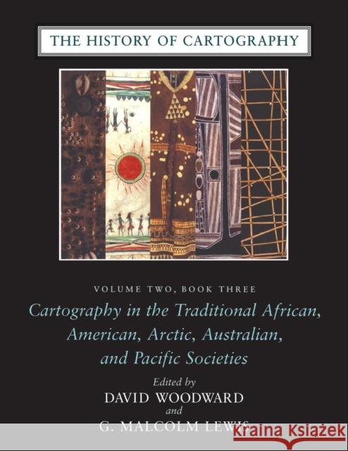 |
The History of Cartography, Volume 2, Book 3: Cartography in the Traditional African, American, Arctic, Australian, and Pacific Societies
ISBN: 9780226907284 / Angielski / Twarda / 500 str. Termin realizacji zamówienia: ok. 5-8 dni roboczych. "Certain to be the standard reference for all subsequent scholarship." John Noble Wilford, "New York Times Book Review," on the "History of Cartography" series
"The maps in this book provide an evocative picture of how indigenous peoples view and represent their worlds. They illuminate not only questions of material culture but also the cognitive systems and social motivations that underpin them" (from the introduction). Although they are often rendered in forms unfamiliar to Western eyes, maps have existed in most cultures. In this latest book of the acclaimed "History of... "Certain to be the standard reference for all subsequent scholarship." John Noble Wilford, "New York Times Book Review," on the "History of Cartograph...
|
cena:
1232,28 zł |
 |
Map Projection Transformation: Principles and Applications
ISBN: 9780748406685 / Angielski / Miękka / 388 str. Termin realizacji zamówienia: ok. 5-8 dni roboczych. With the advance of science and technology, there have been breakthroughs in the field of classical research and methods of map projection. Among these, computer science and space science have had the greater influence upon the field of research and the formation of a working body of map projection, developing them in breadth and depth.
This book reflects several aspects of the development of modern mathematical cartography, especially the theory and methods of map projection transformation. Map projection transformation is an area of research in mathematical cartography newly developed... With the advance of science and technology, there have been breakthroughs in the field of classical research and methods of map projection. Among thes...
|
cena:
438,95 zł |
 |
The Piri Reis Map of 1513
ISBN: 9780820321578 / Angielski / Twarda / 240 str. Termin realizacji zamówienia: ok. 5-8 dni roboczych. One of the most beautiful maps to survive the Great Age of Discoveries, the 1513 world map drawn by Ottoman admiral Piri Reis is also one of the most mysterious. Gregory McIntosh has uncovered new evidence in the map that shows it to be among the most important ever made. This detailed study offers new commentary and explication of a major milestone in cartography. Correcting earlier work of Paul Kahle and pointing out the traps that have caught subsequent scholars, McIntosh disproves the dubious conclusion that the Reis map embodied Columbus's Third Voyage map of 1498, showing that it... One of the most beautiful maps to survive the Great Age of Discoveries, the 1513 world map drawn by Ottoman admiral Piri Reis is also one of the mo... |
cena:
246,71 zł |
 |
Cartographic Science: A Compendium of Map Projections, with Derivations
ISBN: 9780849381690 / Angielski / Twarda / 504 str. Termin realizacji zamówienia: ok. 5-8 dni roboczych. Geographic books routinely introduce map projections without providing mathematical explanations of projections and few delve into complex mathematical development or cover the breadth of projections. From basic projecting to advanced transformations, Cartographic Science: A Compendium of Map Projections, with Derivations is a comprehensive reference that offers an explanation of the science of cartography.
The book is a compilation of more than a hundred map projections, from classic conics to contemporary transformations using complex variables. Starting from widely described geometric... Geographic books routinely introduce map projections without providing mathematical explanations of projections and few delve into complex mathematica...
|
cena:
707,28 zł |
 |
Mapping in Michigan & the Great Lakes Region
ISBN: 9780870138072 / Angielski / Twarda / 377 str. Termin realizacji zamówienia: ok. 5-8 dni roboczych. An illustrated chapter on the renowned Michigan map expert Louis Karpinski opens this volume, following a comparative introduction by the noted cartographic historian David Buisseret. Twelve chapters tell particular stories. Often these narratives extend well beyond the limits of today's state of Michigan. Ameican Indian mapmakers sought to give directions and convey cosmological meanings and political relationships; only gradually did they adopt the geometric framing and uniformity of European maps, which reflected a different set of cultural attitudes. Would-be colonial governors mapped... An illustrated chapter on the renowned Michigan map expert Louis Karpinski opens this volume, following a comparative introduction by the noted ca... |
cena:
126,58 zł |
 |
The Void, the Grid & the Sign: Traversing the Great Basin
ISBN: 9780874176186 / Angielski / Miękka / 240 str. Termin realizacji zamówienia: ok. 5-8 dni roboczych. What Barry Lopez did in expanding our vision of the frozen North in Arctic Dreams, William Fox has done in broadening our perceptions of the desert expanses of the West's Great Basin.
Roughly a quarter of a million acres of land spanning much of Utah and most of Nevada, the Great Basin is the highest and driest of the American deserts, a vast empty tract on the nineteenth-century maps of our continent. Explorers and cartographers found it imponderable; pioneers and settlers found it uninhabitable. And today the Great Basin remains a largely unknown and forbidding landscape, one that... What Barry Lopez did in expanding our vision of the frozen North in Arctic Dreams, William Fox has done in broadening our perceptions of the desert ex...
|
cena:
82,88 zł |
 |
Spatial Database Systems: Design, Implementation and Project Management
ISBN: 9781402053931 / Angielski / Miękka / 553 str. Termin realizacji zamówienia: ok. 5-8 dni roboczych. The decision to write this book was motivated by a number of factors. First, although several useful textbooks on spatial databases have recently been published, this is an area of spatial information science that has lagged somewhat behind the rapid advances of the technology and the profusion of books on domain-specific applications. Second, much of the information pertaining to spatial database technologies is only available in scattered journal papers and conference proceedings, and prior to this book no single effort has been made to sift through this expansive literature and unite the...
The decision to write this book was motivated by a number of factors. First, although several useful textbooks on spatial databases have recently been...
|
cena:
1533,32 zł |
 |
Cartography
ISBN: 9781410222183 / Angielski / Miękka / 128 str. Termin realizacji zamówienia: ok. 5-8 dni roboczych. |
cena:
107,60 zł |
 |
Aerial Mapping: Methods and Applications, Second Edition
ISBN: 9781566705578 / Angielski / Twarda / 218 str. Termin realizacji zamówienia: ok. 5-8 dni roboczych. Building on the foundation of the bestselling first edition, Aerial Ma pping: Methods and Applications, Second Edition provides you with a pr actical understanding of aerial photography, remote sensing, and photo grammetric mapping. The content is deliberately semi-technical and pro cesses are discussed in a manner easily accessible to anyone regardles s of their technical or scientific background. This new edition highli ghts the significant changes in equipment and techniques. High-speed c omputers, scanners, and remote sensors have changed the way mapping is done. The principles of...
Building on the foundation of the bestselling first edition, Aerial Ma pping: Methods and Applications, Second Edition provides you with a pr actical ...
|
cena:
926,78 zł |
 |
International Perspectives on Maps and the Internet
ISBN: 9783540720287 / Angielski / Twarda / 441 str. Termin realizacji zamówienia: ok. 5-8 dni roboczych. 1 International Perspectives on Maps and the Internet: An Introduction Michael P. Peterson . . . . . . . . . . . . . . . . . . . . . . . . . . . . . . . . . . . . . . . . . . . . . . . . . . . . . . . . . . . . . . . . . . . . . . . . . . . . . . . . . . . . . . . 3 2 Delivering geospatial information with Web 2. 0 William Cartwright . . . . . . . . . . . . . . . . . . . . . . . . . . . . . . . . . . . . . . . . . . . . . . . . . . . . . . . . . . . . . . . . . . . . . . . . . . . . . . . . . . . . . . . . 11 3 Map design for the Internet Bernhard Jenny, Helen Jenny, Stefan Raber . . . . . ....
1 International Perspectives on Maps and the Internet: An Introduction Michael P. Peterson . . . . . . . . . . . . . . . . . . . . . . . . . . . . . ....
|
cena:
806,99 zł |
 |
Introduction to Modern Photogrammetry
ISBN: 9780471309246 / Angielski / Miękka / 496 str. Termin realizacji zamówienia: ok. 5-8 dni roboczych. This book is designed to give the reader a strong grounding in the mathematical basis of photogrammetry while introducing them to the related fields, such as remote sensing and digital image processing, which are increasingly important to photogrammetric research and practice.
This book is designed to give the reader a strong grounding in the mathematical basis of photogrammetry while introducing them to the related fields, ...
|
cena:
1242,30 zł |
 |
Web Cartography
ISBN: 9780748408696 / Angielski / Miękka / 228 str. Termin realizacji zamówienia: ok. 5-8 dni roboczych. Maps and atlases are created as soon as information on our geography has been clarified. They are used to find directions or to get insight into spatial relations. They are produced and used both on paper as well as on-screen. The Web is the new medium for spreading and using maps. This book explains the benefits of this medium from the perspective of the user, and the map provider. Opportunities and pitfalls are illustrated by a set of case-studies. A website accompanies the book and provides a dynamic environment for demonstrating many of the principles set out in the text, including access...
Maps and atlases are created as soon as information on our geography has been clarified. They are used to find directions or to get insight into spati...
|
cena:
341,40 zł |
 |
Ausgleichungsrechnung
ISBN: 9783110190557 / Niemiecki / Twarda / 508 str. Termin realizacji zamówienia: ok. 5-8 dni roboczych. Das Buch legt, nach einer Behandlung des notwendigen statistischen Basiswissens, die grundlegenden Methoden und Verfahren der Ausgleichungsrechnung ausfuhrlich dar. Moderne Konzepte und Losungsansatze werden ausfuhrlich diskutiert. Die heute immer wichtiger werdende Transformationsproblematik, die Approximation von Funktionen sowie Fragen der Deformationsanalyse runden das Themenspektrum dieses Lehrbuches ab.
Das Buch legt, nach einer Behandlung des notwendigen statistischen Basiswissens, die grundlegenden Methoden und Verfahren der Ausgleichungsrechnung... |
cena:
191,46 zł |
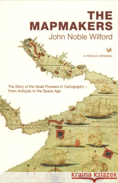 |
The Mapmakers
ISBN: 9780712668125 / Angielski / Miękka / 528 str. Termin realizacji zamówienia: ok. 5-8 dni roboczych. An updated edition of the classic history of cartography, this work traces the adventures, discoveries and feats of technical ingenuity by which mapmakers, over the centuries, have succeeded in charting first the surface of the globe, then the earth's interior and the ocean floors, and finally the moon and the planets of our solar system. This edition includes three new chapters, as well as many updates and amplifications, to reflect the great changes that have taken places in mapmaking in the past two decades.
An updated edition of the classic history of cartography, this work traces the adventures, discoveries and feats of technical ingenuity by which mapma...
|
cena:
123,23 zł |
 |
Map-Based Mobile Services: Design, Interaction and Usability
ISBN: 9783540371090 / Angielski / Twarda / 368 str. Termin realizacji zamówienia: ok. 5-8 dni roboczych. The worldwide popularisation of mobile communication technologies and the incre- ing awareness of usability issues since 1990's have been urging map designers to s- cialise and extend cartographic semiotics, visualisation styles and map use techniques for mobile contexts and small display devices. As a follow-up to the first book "M- based Mobile Services - Theories, Methods and Implementations" published in 2005, this new one is devoted to design strategies, user interactions and usability issues. It addresses methods and techniques for topics that range from design and rendering, context...
The worldwide popularisation of mobile communication technologies and the incre- ing awareness of usability issues since 1990's have been urging map d...
|
cena:
605,23 zł |
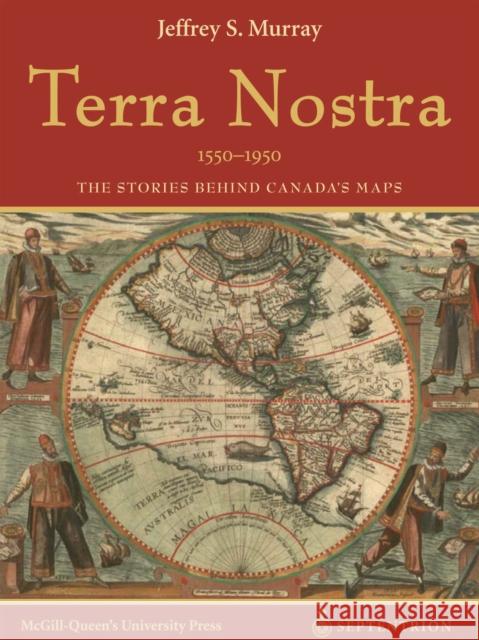 |
Terra Nostra, 1550-1950: The Stories Behind Canada's Maps
ISBN: 9782894484531 / Angielski / Twarda / 192 str. Termin realizacji zamówienia: ok. 5-8 dni roboczych. Terra Nostra celebrates the mapping of Canada, in part by telling the stories of the exceptional individuals who helped to create the maps. Drawn from the rich cartographic holdings of Library and Archives Canada, it spans four centuries - from the portolan charts of the early explorers to recent aerial images of east coast ice floes. Canada's maps provide evidence of our nation's technical accomplishments and offer insight into the development of our geographical knowledge.
This year marks the 100th anniversary of the official Atlas of Canada; Terra Nostra provides a beautifully... Terra Nostra celebrates the mapping of Canada, in part by telling the stories of the exceptional individuals who helped to create the maps. Drawn from...
|
cena:
312,18 zł |
 |
Thematic Cartography, Set
ISBN: 9781848211094 / Angielski / Twarda / 1280 str. Termin realizacji zamówienia: ok. 5-8 dni roboczych. This series in three volumes considers maps as constructions resulting from a number of successive transformations and stages integrated in a logical reasoning and an order of choices.
This series in three volumes considers maps as constructions resulting from a number of successive transformations and stages integrated in a logical ...
|
cena:
2897,15 zł |
 |
Semiology of Graphics: Diagrams, Networks, Maps
ISBN: 9781589482616 / Angielski / Twarda / 456 str. Termin realizacji zamówienia: ok. 5-8 dni roboczych. Originally published in French in 1967, "Semiology of Graphics" holds a significant place in the theory of information design. Founded on Jacques Bertin’s practical experience as a cartographer, Part One of this work is an unprecedented attempt to synthesize principles of graphic communication with the logic of standard rules applied to writing and topography. Part Two brings Bertin’s theory to life, presenting a close study of graphic techniques including shape, orientation, color, texture, volume, and size in an array of more than 1,000 maps and diagrams. Originally published in French in 1967, "Semiology of Graphics" holds a significant place in the theory of information design. Founded on Jacques B... |
cena:
364,50 zł |
 |
Samuel de Champlain before 1604 : Des Sauvages and other Documents Related to the Period
ISBN: 9780773537576 / Angielski / Twarda / 526 str. Termin realizacji zamówienia: ok. 5-8 dni roboczych. The French explorer, surveyor, cartographer, and diplomat Samuel de Champlain (c. 1575-1635) is often called the Father of New France for founding the settlement that became Quebec City, governing New France, and mapping much of the St. Lawrence and eastern Great Lakes region. Champlain was also a prolific writer who documented his experiences in the Americas, including his travels, impressions of the New World, and encounters and alliances with native peoples.
The French explorer, surveyor, cartographer, and diplomat Samuel de Champlain (c. 1575-1635) is often called the Father of New France for founding the...
|
cena:
390,22 zł |
 |
Cartographic Relief Presentation
ISBN: 9783110067118 / Niemiecki / Twarda / 407 str. Termin realizacji zamówienia: ok. 5-8 dni roboczych. Eduard Imhof's classic book Cartographic Relief Presentation is once again available. Within the discipline of cartography, few works are considered classics in the sense of retaining their interest, relevance, and inspiration with the passage of time. One such work is Imhof's masterpiece on relief representation, As a unique display of analysis and portrayal, this is an outstanding example of the need for cartography to combine intellect and graphics in solving map design problems. The range, detail, and scientific artistry of his solutions are presented in a teaching context that puts this...
Eduard Imhof's classic book Cartographic Relief Presentation is once again available. Within the discipline of cartography, few works are considered c...
|
cena:
681,28 zł |


