Wyniki wyszukiwania:
wyszukanych pozycji: 23
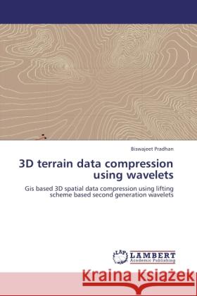 |
3D terrain data compression using wavelets
ISBN: 9783846528280 / Angielski / Miękka / 220 str. Termin realizacji zamówienia: ok. 10-14 dni roboczych. The most complex GIS data are three dimensional terrain data in GIS applications, for a realistic representation of a terrain, the Digital Elevation Model (DEM) is not suitable for direct use in on-line GIS services due to its large size and inflexibility data structure. Image compression is a key factor to improve transmission speed and storage, but it risks losing relevant terrain information. Very little work has been done till date on the GIS terrain data compression based on second generation wavelets. Second generation wavelet technology provides an efficient compression tool to achieve...
The most complex GIS data are three dimensional terrain data in GIS applications, for a realistic representation of a terrain, the Digital Elevation M...
|
cena:
353,37 |
 |
Gcec 2017: Proceedings of the 1st Global Civil Engineering Conference
ISBN: 9789811080159 / Angielski / Twarda / 2018 / 1541 str. Termin realizacji zamówienia: ok. 22 dni roboczych. This book gathers the proceedings of the 1st Global Civil Engineering Conference, GCEC 2017, held in Kuala Lumpur, Malaysia, on July 25-28, 2017. The scope of the book spans the following areas: Structural, Water Resources, Geotechnical, Construction, Transportation Engineering and Geospatial Engineering applications.
This book gathers the proceedings of the 1st Global Civil Engineering Conference, GCEC 2017, held in Kuala Lumpur, Malaysia, on July 25-28, 2017. The ...
|
cena:
1207,67 |
 |
Spatial Modelling of Flood Risk and Flood Hazards: Societal Implications
ISBN: 9783030945435 / Angielski / Twarda / 2022 Termin realizacji zamówienia: ok. 22 dni roboczych. Floods and flash floods with hydro-meteorological and tropical cyclones are the some of the most devastating natural disasters causing massive damages to natural and man-made features. Flood hazards are a major threat to human life, properties (agricultural area, yield production, building and homes) and infrastructures (bridges, roads, railways, urban infrastructures, etc). Flood hazards susceptibility mapping (risk assessment) and modelling is an essential step for early warning systems, emergency services, prevention and mitigation of future environmental and social hazards... Floods and flash floods with hydro-meteorological and tropical cyclones are the some of the most devastating natural disasters causing massive dama... |
cena:
724,58 |
 |
Laser Scanning Systems in Highway and Safety Assessment: Analysis of Highway Geometry and Safety Using Lidar
ISBN: 9783030103736 / Angielski / Twarda / 2019 / 157 str. Termin realizacji zamówienia: ok. 22 dni roboczych. |
cena:
442,79 |
 |
Gcec 2017: Proceedings of the 1st Global Civil Engineering Conference
ISBN: 9789811340420 / Angielski / Miękka / 2019 / 1541 str. Termin realizacji zamówienia: ok. 22 dni roboczych. This book gathers the proceedings of the 1st Global Civil Engineering Conference, GCEC 2017, held in Kuala Lumpur, Malaysia, on July 25-28, 2017. The scope of the book spans the following areas: Structural, Water Resources, Geotechnical, Construction, Transportation Engineering and Geospatial Engineering applications.
This book gathers the proceedings of the 1st Global Civil Engineering Conference, GCEC 2017, held in Kuala Lumpur, Malaysia, on July 25-28, 2017. The ...
|
cena:
881,63 |
 |
Terrigenous Mass Movements: Detection, Modelling, Early Warning and Mitigation Using Geoinformation Technology
ISBN: 9783642427787 / Angielski / Miękka / 2014 / 400 str. Termin realizacji zamówienia: ok. 22 dni roboczych. Terrestrial mass movements (i.e. cliff collapses, soil creeps, mudflows, landslides etc.) are severe forms of natural disasters mostly occurring in mountainous terrain, which is subjected to specific geological, geomorphological and climatological conditions, as well as to human activities. It is a challenging task to accurately define the position, type and activity of mass movements for the purpose of creating inventory records and potential vulnerability maps. Remote sensing techniques, in combination with Geographic Information System tools, allow state-of-the-art investigation of the... Terrestrial mass movements (i.e. cliff collapses, soil creeps, mudflows, landslides etc.) are severe forms of natural disasters mostly occurring in... |
cena:
402,53 |
 |
Laser Scanning Applications in Landslide Assessment
ISBN: 9783319856339 / Angielski / Miękka / 2018 / 359 str. Termin realizacji zamówienia: ok. 22 dni roboczych. |
cena:
603,81 |
 |
Terrigenous Mass Movements: Detection, Modelling, Early Warning and Mitigation Using Geoinformation Technology
ISBN: 9783642254949 / Angielski / Twarda / 2012 / 400 str. Termin realizacji zamówienia: ok. 22 dni roboczych. Terrestrial mass movements (i.e. cliff collapses, soil creeps, mudflows, landslides etc.) are severe forms of natural disasters mostly occurring in mountainous terrain, which is subjected to specific geological, geomorphological and climatological conditions, as well as to human activities. It is a challenging task to accurately define the position, type and activity of mass movements for the purpose of creating inventory records and potential vulnerability maps. Remote sensing techniques, in combination with Geographic Information System tools, allow state-of-the-art investigation of the... Terrestrial mass movements (i.e. cliff collapses, soil creeps, mudflows, landslides etc.) are severe forms of natural disasters mostly occurring in... |
cena:
402,53 |
 |
Laser Scanning Applications in Landslide Assessment
ISBN: 9783319553412 / Angielski / Twarda / 2017 / 359 str. Termin realizacji zamówienia: ok. 22 dni roboczych. This book is related to various applications of laser scanning in landslide assessment. Landslide detection approaches, susceptibility, hazard, vulnerability assessment and various modeling techniques are presented. Optimization of landslide conditioning parameters and use of heuristic, statistical, data mining approaches, their advantages and their relationship with landslide risk assessment are discussed in detail. The book contains scanning data in tropical forests; its indicators, assessment, modeling and implementation. Additionally, debris flow modeling and analysis including source of...
This book is related to various applications of laser scanning in landslide assessment. Landslide detection approaches, susceptibility, hazard, vulner...
|
cena:
603,81 |
 |
Spatial Modeling and Assessment of Urban Form: Analysis of Urban Growth: From Sprawl to Compact Using Geospatial Data
ISBN: 9783319853444 / Angielski / Miękka / 2018 / 331 str. Termin realizacji zamówienia: ok. 22 dni roboczych. |
cena:
603,81 |
 |
Spatial Modeling and Assessment of Urban Form: Analysis of Urban Growth: From Sprawl to Compact Using Geospatial Data
ISBN: 9783319542164 / Angielski / Twarda / 2017 / 331 str. Termin realizacji zamówienia: ok. 22 dni roboczych. This book discusses the application of Geospatial data, Geographic Information System (GIS) and Remote Sensing (RS) technologies in analysis and modeling of urban growth process, and its pattern, with special focus on sprawl and compact form of urban development. The book explains these two kinds of urban forms (sprawl and compact urban development) in detail regarding their advantages, disadvantages, indicators, assessment, modeling, implementation and their relationship with urban sustainability. It confirms that the proposed modeling approaches, geospatial data and GIS are very practical...
This book discusses the application of Geospatial data, Geographic Information System (GIS) and Remote Sensing (RS) technologies in analysis and model...
|
cena:
603,81 |
 |
Iot Sensors, ML, AI and Xai: Empowering a Smarter World
ISBN: 9783031686016 / Angielski Termin realizacji zamówienia: ok. 22 dni roboczych. |
cena:
805,10 |
 |
Iot Sensors, ML, AI and Xai: Empowering a Smarter World
ISBN: 9783031686047 / Angielski Termin realizacji zamówienia: ok. 22 dni roboczych. |
cena:
644,07 |
 |
Global Land-Ocean Geospatial Applications: Mapping and Surveying with Remote Sensing and GIS
ISBN: 9781032728612 / Angielski Termin realizacji zamówienia: ok. 22 dni roboczych. |
cena:
636,71 |
 |
Technology-Based Solutions for Sustainable Groundwater Management: Challenges, Models, and Strategies
ISBN: 9780443337871 / Angielski Termin realizacji zamówienia: ok. 30 dni roboczych. |
cena:
732,03 |
 |
Proceedings of Uasg 2021: Wings 4 Sustainability: Unmanned Aerial System in Geomatics
ISBN: 9783031193118 / Angielski Termin realizacji zamówienia: ok. 22 dni roboczych. |
cena:
885,61 |
 |
Proceedings of UASG 2021: Wings 4 Sustainability: Unmanned Aerial System in Geomatics
ISBN: 9783031193088 / Angielski / Twarda / 2023 / 542 str. Termin realizacji zamówienia: ok. 22 dni roboczych. This volume gathers the latest advances, innovations, and applications in the field of geographic information systems and unmanned aerial vehicle (UAV) technologies, as presented by leading researchers and engineers at the 2ndInternational Conference on Unmanned Aerial System in Geomatics (UASG), held in Roorkee, India on April 2-4, 2021. It covers highly diverse topics, including photogrammetry and remote sensing, surveying, UAV manufacturing, geospatial data sensing, UAV processing, visualization, and management, UAV applications and regulations, geo-informatics and geomatics. The...
This volume gathers the latest advances, innovations, and applications in the field of geographic information systems and unmanned aerial vehicle (UAV...
|
cena:
885,61 |
 |
Multispectral and Hyperspectral Remote Sensing Data for Mineral Exploration and Environmental Monitoring of Mined Areas
ISBN: 9783036512648 / Angielski / Twarda / 2021 / 416 str. Termin realizacji zamówienia: ok. 16-18 dni roboczych. |
cena:
377,64 |
 |
Big Data Analytics in Agriculture: Algorithms and Applications
ISBN: 9780323999328 / Angielski / Miękka / 2025 Termin realizacji zamówienia: ok. 30 dni roboczych. |
cena:
799,10 |
 |
Machine Learning in Geohazard Risk Prediction and Assessment: From Microscale Analysis to Regional Mapping
ISBN: 9780443236631 / Angielski Termin realizacji zamówienia: ok. 30 dni roboczych. |
cena:
695,43 |


