ISBN-13: 9783031392733 / Angielski / Twarda / 2023
cena 195,87 zł (netto: 186,54 VAT: 5%)
Najniższa cena z 30 dni: 192,74 zł
Termin realizacji zamówienia: ok. 20 dni roboczych.
Darmowa dostawa!
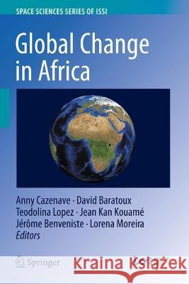
The main objective of this book is to provide an overview of the benefit of using Earth Observation data to monitor global environmental changes due to natural phenomena and anthropogenic forcing factors over the African continent, and highlight a number of applications of high societal relevance.
The main topics presented in the book concern: water resources, floods and droughts, coastal zones changes and exploitation of mineral resources and its impact on the environment.
The chapters "Enhancing the Uptake of Earth Observation Products and Services in Africa Through a Multi-level Transdisciplinary Approach", "Water Resources in Africa under Global Change: Monitoring Surface Waters from Space", "Correction to: Water Resources in Africa under Global Change: Monitoring Surface Waters from Space", "Water Resources in Africa: The Role of Earth Observation Data and Hydrodynamic Modeling to Derive River Discharge", "The Role of Space-Based Observations for Groundwater Resource Monitoring over Africa", "Hydrometeorological Extreme Events in West Africa: Droughts", "Hydrometeorological Extreme Events in Africa: The Role of Satellite Observations for Monitoring Pluvial and Fluvial Flood Risk", "Artisanal Exploitation of Mineral Resources: Remote Sensing Observations of Environmental Consequences, Social and Ethical Aspects" and "Coastal Zone Changes in West Africa: Challenges and Opportunities for Satellite Earth Observations" are available open access under a Creative Commons Attribution 4.0 International License via link.springer.com.
Previously published in Surveys in Geophysics, Volume 44, Issue 1, 2023
Anny Cazenave is an Emeritus scientist at the ‘Laboratoire d’Etudes en Géophysique et Océanographie Spatiale’, Toulouse, France. Her research deals with the applications of space techniques to geosciences (geodesy, solid Earth geophysics, sea level change and climatic causes, land hydrology from space).
David Baratoux is a senior scientist at the French National Research Institute for Sustainable development, and researcher at the laboratory Geosciences Environnement Toulouse (GET). He is the founder and co-director of the Joint International Laboratory for Responsible Mining in West Africa (LMI MINERWA). He was affected during 4 years (2014 – 2018) at the University Cheikh Anta Diop of Dakar (UCAD, Senegal) and is currently working (2021 – 2025) at the University Félix Houphouët-Boigny in Abidjan, Côte d’Ivoire. He is also strongly involved in the promotion of planetary and space sciences in Africa and was made Officer of the National Order of the Lion, by the President of Senegal.
Teodolina Lopez is a researcher and project manager at Cerema. She received a Ph.D. degree in planetary science from the University Toulouse III in 2011. After different post-doctoral positions in France, she held an Earth Science post-doctoral position, from 2016 to 2019, at the International Space Science Institute (ISSI) in Bern, Switzerland. Her research focuses on the characterisation in (semi-) arid regions of the groundwater flow and transfers and their interaction with the atmosphere. This approach relies on the synergy between Earth Observation dataset (mostly thermal infrared and gravity) with in situ measurements (geophysical, geochemical and geology) and simulations. She also promotes the use of various Earth Observation data to local and public entities.
Jean Kan Kouamé, Lecturer and Researcher at the UFR of Earth Sciences and Mining Resources and Director of the University Centre for Research and Application in Remote Sensing (CURAT) since 2017, obtained his PhD in Earth Sciences, option : Hydrogeology and GIS, at the University of Félix Houphouët-Boigny, Abidjan, Ivory Coast, in 2007. After a post-doc at the Amos campus of the University of Quebec in Abitibi-Témiscamingue (Quebec, Canada) on the modelling of the transfer of pollutants contained in the toxic waste dumped in the District of Abidjan, in 2009, KOUAME Kan Jean rejoiced his University of origin and led a project financed by the Strategic Support Programme for Research and Higher Education (PASRES) on the demarcation of the protection perimeters of the Bonoua catchment works (South-East of Ivory Coast) in 2015. Since 2017, he is Director of CURAT and works with earth observation tools applied to the field of the Environment and especially the impacts of the practice of agriculture, uncontrolled urbanization and illegal gold panning on the vegetation cover. In March 2023, he has just carried out a test area for the re-vegetation of a gold panning site in Kokumbo, a locality located in the centre of Côte d'Ivoire, after having demonstrated the strong degradation of this area using satellite images.
Jérôme Benveniste received his PhD in Oceanography from Space from the University of Toulouse, France, in 1989. After a Post-Doc in space data assimilation in ocean models at MIT, Boston, USA, he moved to the European Space Agency. He has been at the ESA Earth Observation centre near Rome since 1992, where he is in charge of boosting the ERS-1, ERS-2, ENVISAT, CryoSat, Sentinel-3 and Sentinel-6 radar altimetry data exploitation. He interacts with ESA Principal Investigators, organises scientific symposia, and regularly launches Research and Development projects in Geodesy, Oceanography, Hydrology and the Cryosphere, including GOCE data exploitation. He was recognised as Senior Advisor at ESA in 2008 and is vice-chair of the COSPAR Earth Observation Commission. He is co-Editor of a Springer book on Coastal Zone Radar Altimetry, published in 2011 and several other books since. He is Editor of a peer-reviewed Scientific Journal and Guest-Editor of five Journal Special Issues. Jérôme Benveniste launched and monitors the Climate Change Initiative Sea Level Project (2009-present) and its current sequel focused on the Coastal Zone, as well as other projects on Sea Level Budget Closure, Runoff, River Discharge, Ocean Heat Content, Easter Boundary Upwelling Systems and Coastal Hazards.
Lorena Moreira is an Earth Observation scientist with a background in two essential climate variables, ozone and sea level. She has coauthored about 15 publications including Atmospheric Chemistry and Physics, Proceeding of the Roya society A, Earth Planets and Space, Global and Planetary Change, Remote Sensing, Surveys in Geophysics, etc. Dr. Moreira is a project scientist at Mercator Ocean international, contributing to the Copernicus Marine Service Ocean reporting framework activities.
The main objective of this book is to provide an overview of the benefit of using Earth Observation data to monitor global environmental changes due to natural phenomena and anthropogenic forcing factors over the African continent, and highlight a number of applications of high societal relevance.
The main topics presented in the book concern: water resources, floods and droughts, coastal zones changes and exploitation of mineral resources and its impact on the environment.
The chapters "Enhancing the Uptake of Earth Observation Products and Services in Africa Through a Multi-level Transdisciplinary Approach", "Water Resources in Africa under Global Change: Monitoring Surface Waters from Space", "Correction to: Water Resources in Africa under Global Change: Monitoring Surface Waters from Space", "Water Resources in Africa: The Role of Earth Observation Data and Hydrodynamic Modeling to Derive River Discharge", "The Role of Space-Based Observations for Groundwater Resource Monitoring over Africa", "Hydrometeorological Extreme Events in West Africa: Droughts", "Hydrometeorological Extreme Events in Africa: The Role of Satellite Observations for Monitoring Pluvial and Fluvial Flood Risk", "Artisanal Exploitation of Mineral Resources: Remote Sensing Observations of Environmental Consequences, Social and Ethical Aspects" and "Coastal Zone Changes in West Africa: Challenges and Opportunities for Satellite Earth Observations" are available open access under a Creative Commons Attribution 4.0 International License via link.springer.com.
Previously published in Surveys in Geophysics, Volume 44, Issue 1, 2023