Family Maps of LaSalle County, Illinois » książka


Family Maps of LaSalle County, Illinois
ISBN-13: 9781420314731 / Angielski / Miękka / 2010 / 518 str.
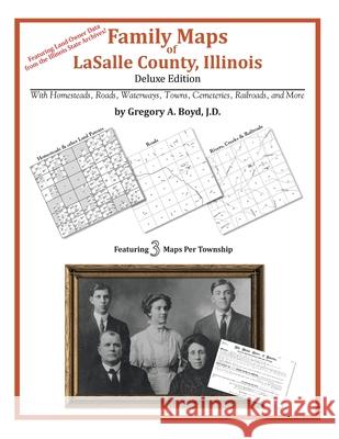
508 pages with 101 total maps Locating original landowners in maps has never been an easy task-until now. This volume in the Family Maps series contains newly created maps of original landowners (patent maps) in what is now LaSalle County, Illinois, gleaned from the indexes of the Illinois State Archives. But it offers much more than that. For each township in the county, there are two additional maps accompanying the patent map: a road map and a map showing waterways, railroads, and both modern and many historical city-centers and cemeteries. Included are indexes to help you locate what you are looking for, whether you know a person's name, a last name, a place-name, or a cemetery. The combination of maps and indexes are designed to aid researchers of American history or genealogy to explore frontier neighborhoods, examine family migrations, locate hard-to-find cemeteries and towns, as well as locate land based on legal descriptions found in old documents or deeds. The patent-maps are essentially plat maps but instead of depicting owners for a particular year, these maps show original landowners, no matter when the transfer from the federal government was completed. Dates of patents typically begin near the time of statehood and run into the early 1900s. What's Mapped in this book (that you'll not likely find elsewhere) . . . 7178 Parcels of Land (with original landowner names and patent-dates labeled in the relevant map) 97 Cemeteries plus . . . Roads, and existing Rivers, Creeks, Streams, Railroads, and Small-towns (including some historical), etc. What YEARS are these maps for? Here are the counts for parcels of land mapped, by the decade in which the patent applications were made: DecadeParcel-count 1820s2 1830s3155 1840s2854 1850s2146 1860s476 1870s176 1880s141 1890s109 1900s81 1910s3 1940s1 1950s1 1980s1 What Cities and Towns are in LaSalle County, Illinois (and in this book)? Altmar, Bailey Falls (historical), Baker, Blakes, Catharine, Cedar Point, Culton (historical), Dana, Danway, Dayton, Deer Park, Delbert Egan Housing Project, Dimmick, Earlville, Evans Heights Housing Project, Farm Ridge, Fitchmoor, Freedom Centre (historical), Garfield, Grand Ridge, Harding, Hitt, Jonesville, Kangley, Kernan, La Salle, Leeds, Leland, Leonore, Little Rock (historical), Lostant, Lowell, Marseilles, Mendota, Meriden, Milla, Munson (historical), Naplate, Northville, Norway, Oglesby, Ottawa, Otter (historical), Peru, Peterstown, Prairie Center, Ransom, Reed Crossing, Richards, Rutland, Seneca, Serena, Sheridan, South Ottawa (historical), Stavanger, Stoneyville, Streator, Sulphur Springs, Ticona, Tomahawk Bluff, Tonica, Triumph, Troy Grove, Utica, Vermilionville, Waltham, Wedron, Wilsman, Woodland Addition


Czytaj nas na:
KrainaKsiazek.PL - Księgarnia Internetowa


