• Wyszukiwanie zaawansowane
  • Kategorie
  • Kategorie BISAC
  • Książki na zamówienie
  • Promocje
  • Granty
  • Książka na prezent
  • Opinie
  • Pomoc
  • Załóż konto
  • Zaloguj się

Family Maps of Douglas County, Missouri » książka

zaloguj się | załóż konto
Logo Krainaksiazek.pl

koszyk

konto

szukaj
topmenu
Księgarnia internetowa
Szukaj
Książki na zamówienie
Promocje
Granty
Książka na prezent
Moje konto
Pomoc
 
 
Wyszukiwanie zaawansowane
Pusty koszyk
Bezpłatna dostawa dla zamówień powyżej 20 złBezpłatna dostawa dla zamówień powyżej 20 zł

Kategorie główne

• Nauka
 [2946912]
• Literatura piękna
 [1852311]

  więcej...
• Turystyka
 [71421]
• Informatyka
 [150889]
• Komiksy
 [35717]
• Encyklopedie
 [23177]
• Dziecięca
 [617324]
• Hobby
 [138808]
• AudioBooki
 [1671]
• Literatura faktu
 [228371]
• Muzyka CD
 [400]
• Słowniki
 [2841]
• Inne
 [445428]
• Kalendarze
 [1545]
• Podręczniki
 [166819]
• Poradniki
 [480180]
• Religia
 [510412]
• Czasopisma
 [525]
• Sport
 [61271]
• Sztuka
 [242929]
• CD, DVD, Video
 [3371]
• Technologie
 [219258]
• Zdrowie
 [100961]
• Książkowe Klimaty
 [124]
• Zabawki
 [2341]
• Puzzle, gry
 [3766]
• Literatura w języku ukraińskim
 [255]
• Art. papiernicze i szkolne
 [7810]
Kategorie szczegółowe BISAC

Family Maps of Douglas County, Missouri

ISBN-13: 9781420312355 / Angielski / Miękka / 2010 / 354 str.

Gregory a. Boyd J. D.
Family Maps of Douglas County, Missouri Gregory a. Boy 9781420312355 Arphax Publishing Co. - książkaWidoczna okładka, to zdjęcie poglądowe, a rzeczywista szata graficzna może różnić się od prezentowanej.

Family Maps of Douglas County, Missouri

ISBN-13: 9781420312355 / Angielski / Miękka / 2010 / 354 str.

Gregory a. Boyd J. D.
cena 140,26
(netto: 133,58 VAT:  5%)

Najniższa cena z 30 dni: 140,26
Termin realizacji zamówienia:
ok. 16-18 dni roboczych
Bez gwarancji dostawy przed świętami

Darmowa dostawa!

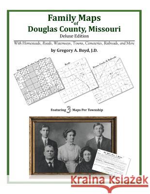
344 pages with 77 total maps Locating original landowners in maps has never been an easy task-until now. This volume in the Family Maps series contains newly created maps of original landowners (patent maps) in what is now Douglas County, Missouri, gleaned from the indexes of the U.S. Bureau of Land Management. But it offers much more than that. For each township in the county, there are two additional maps accompanying the patent map: a road map and a map showing waterways, railroads, and both modern and many historical city-centers and cemeteries. Included are indexes to help you locate what you are looking for, whether you know a person's name, a last name, a place-name, or a cemetery. The combination of maps and indexes are designed to aid researchers of American history or genealogy to explore frontier neighborhoods, examine family migrations, locate hard-to-find cemeteries and towns, as well as locate land based on legal descriptions found in old documents or deeds. The patent-maps are essentially plat maps but instead of depicting owners for a particular year, these maps show original landowners, no matter when the transfer from the federal government was completed. Dates of patents typically begin near the time of statehood and run into the early 1900s. What's Mapped in this book (that you'll not likely find elsewhere) . . . 6675 Parcels of Land (with original landowner names and patent-dates labeled in the relevant map) 70 Cemeteries plus . . . Roads, and existing Rivers, Creeks, Streams, Railroads, and Small-towns (including some historical), etc. What YEARS are these maps for? Here are the counts for parcels of land mapped, by the decade in which the corresponding land patents were issued: DecadeParcel-count 1840s11 1850s376 1860s149 1870s855 1880s795 1890s3049 1900s1096 1910s333 1920s6 What Cities and Towns are in Douglas County, Missouri (and in this book)? Ann, Arden, Arno, Ava, Basher, Bertha, Biggs (historical), Blanche, Brushyknob, Bryant, Buckhart, Champion, Cheney, Coldspring, Cross Roads, Denlow, Depew, Dogwood, Drury, Evans, Fielden, Filer, Gentryville, Girdner, Goodhope, Goodville, Granada, Hale Crossing, Hebron, Hest, Hilo (historical), Holtville, Jackson Mill, Johns Mills (historical), Larissa, Merritt, Midway, Mount Zion, Olathia, Old Merritt, Omba (historical), Ongo, Osborn Crossing, Prior, Red Bank, Richville, Rippee (historical), Rome, Roosevelt, Roy, Sedan (historical), Silverton, Smallett, Squires, Sweden, Tedrick (historical), Tigris, Topaz, Vanzant, Vera Cruz, Witty, Zenda

Kategorie:
Turystyka, Atlasy i mapy
Kategorie BISAC:
Reference > Atlases, Gazetteers & Maps (see also Travel - Maps & Road Atlases)
Wydawca:
Arphax Publishing Co.
Język:
Angielski
ISBN-13:
9781420312355
Rok wydania:
2010
Ilość stron:
354
Waga:
0.81 kg
Wymiary:
27.94 x 21.59 x 1.88
Oprawa:
Miękka
Wolumenów:
01


Udostępnij

Facebook - konto krainaksiazek.pl


Opinie o Krainaksiazek.pl na Opineo.pl

Partner Mybenefit

Krainaksiazek.pl w programie rzetelna firma Krainaksiaze.pl - płatności przez paypal

Czytaj nas na:

Facebook - krainaksiazek.pl
  • książki na zamówienie
  • granty
  • książka na prezent
  • kontakt
  • pomoc
  • opinie
  • regulamin
  • polityka prywatności

Zobacz:

  • Księgarnia czeska

  • Wydawnictwo Książkowe Klimaty

1997-2025 DolnySlask.com Agencja Internetowa

© 1997-2022 krainaksiazek.pl
     
KONTAKT | REGULAMIN | POLITYKA PRYWATNOŚCI | USTAWIENIA PRYWATNOŚCI
Zobacz: Księgarnia Czeska | Wydawnictwo Książkowe Klimaty | Mapa strony | Lista autorów
KrainaKsiazek.PL - Księgarnia Internetowa
Polityka prywatnosci - link
Krainaksiazek.pl - płatnośc Przelewy24
Przechowalnia Przechowalnia