Family Maps of Berrien County, Michigan » książka


Family Maps of Berrien County, Michigan
ISBN-13: 9781420313475 / Angielski / Miękka / 2010 / 276 str.
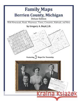
266 pages with 74 total maps Locating original landowners in maps has never been an easy task-until now. This volume in the Family Maps series contains newly created maps of original landowners (patent maps) in what is now Berrien County, Michigan, gleaned from the indexes of the U.S. Bureau of Land Management. But it offers much more than that. For each township in the county, there are two additional maps accompanying the patent map: a road map and a map showing waterways, railroads, and both modern and many historical city-centers and cemeteries. Included are indexes to help you locate what you are looking for, whether you know a person's name, a last name, a place-name, or a cemetery. The combination of maps and indexes are designed to aid researchers of American history or genealogy to explore frontier neighborhoods, examine family migrations, locate hard-to-find cemeteries and towns, as well as locate land based on legal descriptions found in old documents or deeds. The patent-maps are essentially plat maps but instead of depicting owners for a particular year, these maps show original landowners, no matter when the transfer from the federal government was completed. Dates of patents typically begin near the time of statehood and run into the early 1900s. What's Mapped in this book (that you'll not likely find elsewhere) . . . 3403 Parcels of Land (with original landowner names and patent-dates labeled in the relevant map) 39 Cemeteries plus . . . Roads, and existing Rivers, Creeks, Streams, Railroads, and Small-towns (including some historical), etc. What YEARS are these maps for? Here are the counts for parcels of land mapped, by the decade in which the corresponding land patents were issued: DecadeParcel-count 1830s2895 1840s296 1850s199 1860s7 1870s2 1900s3 1920s1 What Cities and Towns are in Berrien County, Michigan (and in this book)? Arden, Bainbridge Center, Bakertown, Baroda, Benton Center, Benton Harbor, Benton Heights, Berrien Center, Berrien Springs, Bertrand, Bethany Beach, Birchwood, Bridgman, Buchanan, Buckhorn, Coloma, Dayton, Derby, Eau Claire, Fair Plain, Fairland, Galien, Glen Lord, Glendora, Gordon Beach, Grand Beach, Harbert, Hartman, Hazelhurst, Higman Park, Hills Corners, Hinchman, Hollywood, Hooks Corner, Jerico, Kings Landing, Lake Michigan Beach, Lakeside, Lakeview, Little Paw Paw Lake, Livingston, Michiana, Millburg, Mizpah Park, Naomi, Napier, New Buffalo, New Troy, Niles, Oxbow, Paw Paw Lake, Pearl Grange, Pennellwood, Riverside, Rosemary Beach, Saint Joseph, Sawyer, Scottdale, Shanghai Corners, Shoreham, Shorewood Hills, Snow, Sodus, Sokol Camp, Spinks Corners, Stevensville, Three Oaks, Tower Hill Shorelands, Turner Shores, Twelve Corners, Union Pier, Vineland, Watervliet, Waverland Beach


Czytaj nas na:
KrainaKsiazek.PL - Księgarnia Internetowa


