"The volume contains not only a broad tapestry of case studies, but also suggestions for future research and pointers to newly available or soon-to-be-available technological possibilities, there is surely something here for all. Historians from other fields, such as military history, cultural history, and the history of science and technology will likewise read this volume with great interest and profit from the change of perspective afforded by its cross-disciplinary content." (Lena Moser, Imago Mundi, Vol. 70 (2), May, 2018)
Part I Mapping Urban Spaces.- A View of Dubrovnik as a Spectacle: Presentations of the Dubrovnik Earthquake of 1667 in European Commercial Cartography.- Mapping the metropolis: analysing map production in Lyon and São Paulo on the first half of the 20th century.- Part II Territory, Sovereignty and Borderlands.- Between Secrecy and Silent Cooperation – The Dissemination of Knowledge about the Republic of Dubrovnik in the Context of the Ottoman–Venetian and Napoleonic Wars.- Cartographic exchange and territorial creation: rewriting northern Japan in the eighteenth and nineteenth centuries.- Part III Map Production and Dissemination of Knowledge.- ‘Back to the Drawing Board’: map-making and the Royal Geographical Society 1831-1990.- Historiographic Mapping of 7th c. BC Egypt: the obliteration of historical complexity.- Part IV Libraries, Accessibility and Specific Cartographic Resources.- Improving User Access to Soviet Military Mapping: A Guide for Map Libraries around the Globe.- User-Centred Design of a Collaborative, Object Oriented Historical GIS-Platform.
Mirela Altić is a chief research fellow at the Institute of Social Sciences in Zagreb, Croatia. At the University of Zagreb’s Department of History, Dr. Altić serves as a full professor and lectures on the history of cartography and historical geography. Besides her specialization in South Eastern and Central European map history, over the last few years she has also published extensively on the Jesuit cartography of the Americas and conducted research in European and American archives and libraries. She is the author of twelve books, numerous scholarly papers and a contributor to The History of Cartography encyclopedia project. Since 2015 she has also served as Vice-Chair of the ICA Commission on the History of Cartography.
Imre Josef Demhardt’s research interests include post-enlightenment cartography, colonialism and regional studies with a focus on Central Europe, Sub-Saharan Africa and North America. Besides numerous articles and several books on these subjects, he is involved as co-editor of Vol. 5 (Nineteenth Century) in the encyclopedia project on the History of Cartography. He holds the Garrett Chair in the History of Cartography at the University of Texas at Arlington and currently serves as Chair of the ICA Commission on the History of Cartography.
Soetkin Vervust is a postdoctoral research fellow at the Free University of Brussels (Belgium) and Newcastle University (UK). Her research interests lie in 18th and 19th century military cartography, the use of digital techniques for the study of historical maps, and their applicability to historical geography and landscape archaeology. Since 2015 she has served as Executive Secretary of the ICA Commission on the History of Cartography.
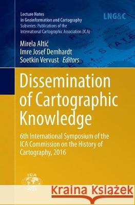
This book gathers 22 papers which were presented at the 6th International Symposium of the ICA Commission on the History of Cartography in Dubrovnik, Croatia on 13–15 October 2016. The overall conference theme was ‘The Dissemination of Cartographic Knowledge: Production – Trade – Consumption – Preservation’. The book presents original research by internationally respected authors in the field of historical cartography, offering a significant contribution to the development of this field of study, but also of geography, history and the GIS sciences. The primary target audience includes researchers, educators, postgraduate students, map librarians and archivists.