Retrospective Fire Modeling: Quantifying the Impacts of Fire Supression » książka
Retrospective Fire Modeling: Quantifying the Impacts of Fire Supression
ISBN-13: 9781480172067 / Angielski / Miękka / 2012 / 46 str.
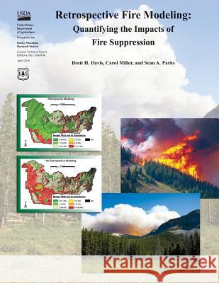
When wildfires are suppressed, opportunities are foregone to create fuel breaks, reduce fire regime departures, and decrease future extreme fire behavior by modifying fuels. To our knowledge, no one has yet attempted to systematically quantify these foregone opportunities. This general technical report describes a methodology to measure the cumulative impacts of suppression over time by modeling the spread of ignitions that were suppressed. We illustrate a set of analysis steps to simulate where ignitions would have spread had they not been suppressed and to assess the cumulative effects that would have resulted from those fires. The quantification of these effects will help land managers improve the prioritization and planning of fuels treatments and help inform decisions about the suppression of future ignitions. In its simplest application, the methodology compares two landscapes: the realized landscape vs. a hypothetical landscape. As used throughout this guidebook, a "landscape" refers mainly to the biophysical characteristics of the study area such as vegetation and fuel conditions and potential fire behavior. The realized landscape is the landscape that resulted due to the fire management strategies actually implemented; this is typically the current landscape. The hypothetical landscape is the landscape that would have resulted if different fire management strategies had been chosen (e.g., if one or more suppressed ignitions had been allowed to burn freely). While the examples in this guidebook compare only two landscapes, any number of landscapes could be compared. A case study examines what conditions might have resulted if lightning-ignited fires were not suppressed in the South Fork Merced watershed of Yosemite National Park. The retrospective modeling process requires modeling the spread of ignitions that were suppressed, updating the fuels data to reflect that modeled fire, and repeating this process to account for all the ignitions of interest throughout the simulation period; this results in the hypothetical landscape. Once the modeling cycles are complete, the final step involves assessing the impacts of fire suppression by comparing the hypothetical and realized landscapes using various metrics depending on need and purpose. For example, the hypothetical and realized landscapes might be compared in terms of potential fire behavior (i.e., flame length or crowning potential). This document is a guidebook in that it provides a moderate level of detail for implementing the methodology and uses a case study to illustrate some procedures. However, it does not provide step-by-step instructions. Furthermore, inputs and parameters used in the case study are for illustration and should not be applied uncritically to other situations. Occasionally, specific tips on how best to accomplish the required steps are offered, but this guidebook is not intended to be a tutorial for specific modeling software, nor is it a text on fire behavior, ecology, or management. To implement the methodology here, the user must have some basic skill sets. The most important skills include basic Geographic Information System (GIS) data manipulation and analysis, experience with fire growth modeling software such as FARSITE (Finney 1998), and familiarity with fire management terminology. Other useful skills include familiarity with other fire modeling software such as FlamMap (Finney 2006) and FireFamilyPlus (FFP; Bradshaw and McCormick 2000), and knowledge of fuels characterization, fire weather analysis, fire behavior, fire ecology, and fire management.
Zawartość książki może nie spełniać oczekiwań – reklamacje nie obejmują treści, która mogła nie być redakcyjnie ani merytorycznie opracowana.


